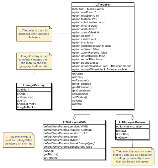
Below is the class diagram for the Leaflet raster classes. As I prepared this diagram I realized it did not go far enough for me since I don’t have experience working the raster images. I’m going to put my exploration of Leaflet classes on hold and take a detour into the world of raster graphics.
I found several posts on Google map tiles, Bing map tiles, and OSM map tiles. The article on OSM map tiles referenced the Slippy Map Tile Application, and Mapnik, an open source tool for rendering maps.
If I start with Mapnik I need some raster tiles to render, don’t I? This would be the perfect time to continue my post from June about working with satellite images with TileMill. In that post I installed the following tools on my computer:
- GDAL, a low-level GIS toolkit
- libgeotiff, to work with geotags
- ImageMagick, an image processing package
- TileMill, an open-source mapmaking app from Mapbox
For my next post, I’ll pick up where I left off and follow the article Processing Landsat 8 Using Open-Source Tools by Charlie Loyd. Then perhaps I’ll look at GMap Creator and MapTiler. I’m open to suggestions for good raster learning resources.
When I’m done I’ll revisit this Leaflet raster class diagram again.

